The Town Planning of Dholavira: A Marvel of the Indus Valley Civilization
One of the most well-known sites of the Indus Valley Civilization, Dholavira, provides an intriguing look into the history, trade, and architectural brilliance of ancient India. Present in the current day Gujarat this place provides us with an opportunity to look into the immaculate town that it. It brings forth the smartness and adaptability of the Harrapans.
ORIGIN
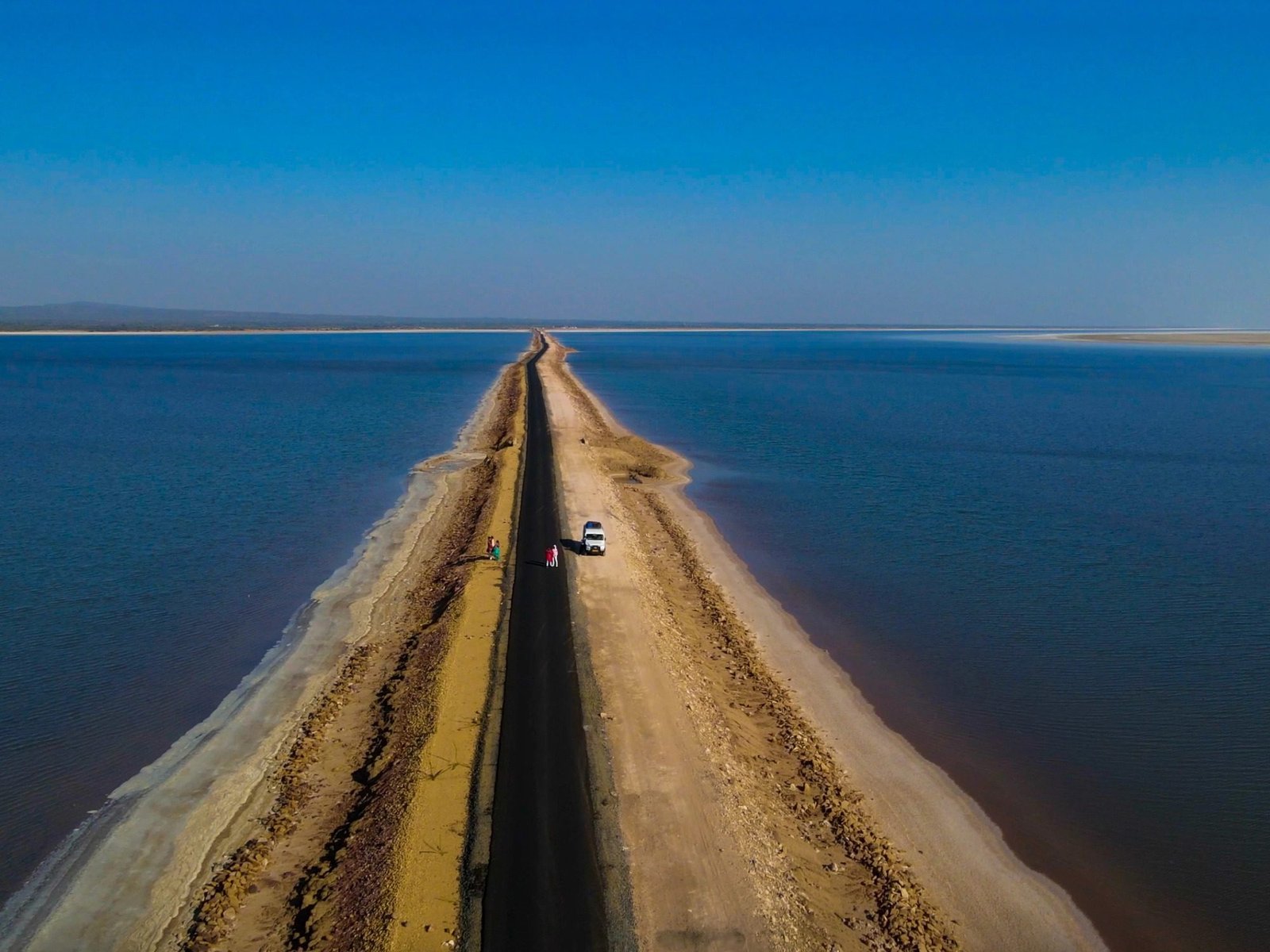
Dating back to around 3000 BCE, Dholavira was one of the biggest and most impressive towns of the ancient Indus Valley Civilization. It comes under the five largest Indus valley civilizations. Situated between two seasonal streams on the dry Khadir Island in Gujarat’s Rann of Kutch, Dholavira was possibly an important source of water for its residents. The city’s location and root were probably impacted by its location on major trade routes.
The origins of the city demonstrate the Harappan people’s resourcefulness in overcoming natural obstacles. The people of Dholavira created a complex system of reservoirs and canals to effectively manage their water supply while living in an area where water scarcity was a common occurrence. Dholavira’s exclusive methods of conserving water made it possible for the community to flourish in an otherwise adverse atmosphere. The meticulous urban layout, which included distinct zones for residential areas, government, and water management, emphasized how important Dholavira was as a highly developed and structured community.
Shambhudan Gadhvi, who was a resident of Dholavira village, noticed the place in the early 1960s and tried to bring the site to the attention of the authorities. The fifth of the eight major Harappan sites, the site was officially discovered and studied by J. P. Joshi of the Archaeological Survey of India (ASI) in 1967-1968. The ASI has been excavating there since 1990 and says, “Dholavira has indeed added new dimensions to the personality of the Indus Valley Civilisation.”
HISTORY
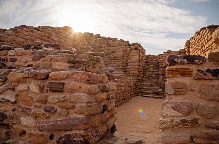
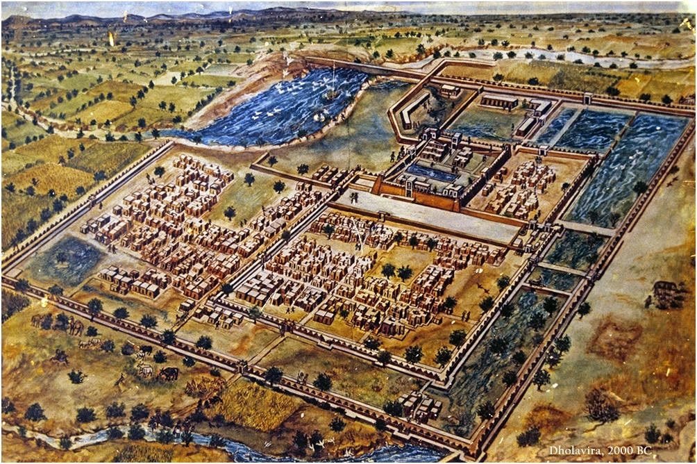
The name Dholavira comes from the village of Dholavira in the Kutch District of Gujarat, where the site is located. It was named as a UNESCO World Heritage Site under the name “Dholavira: A Harappan City” on 27 July 2021. Dholavira was one of the biggest cities of its time, covering an area of around 120 hectares. With the city separated into three distinct sections which were the citadel, the middle town, and the lower town and its layout demonstrated sophisticated urban planning as well.

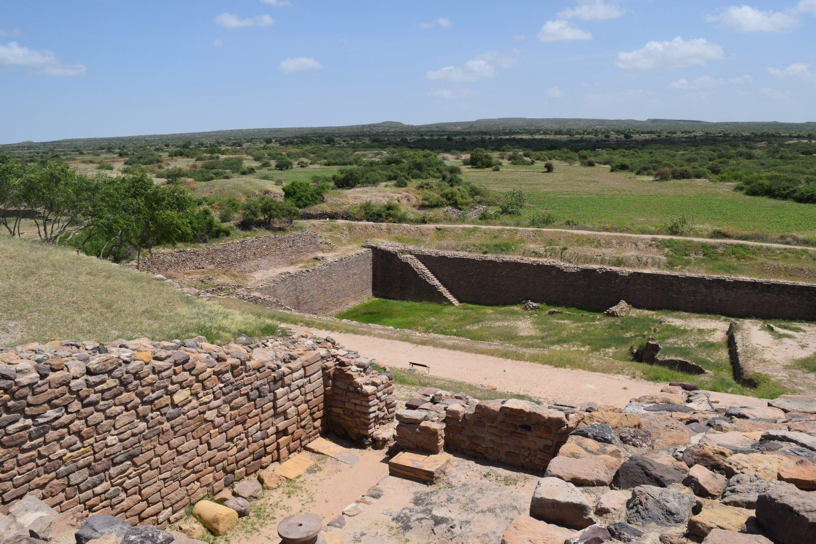
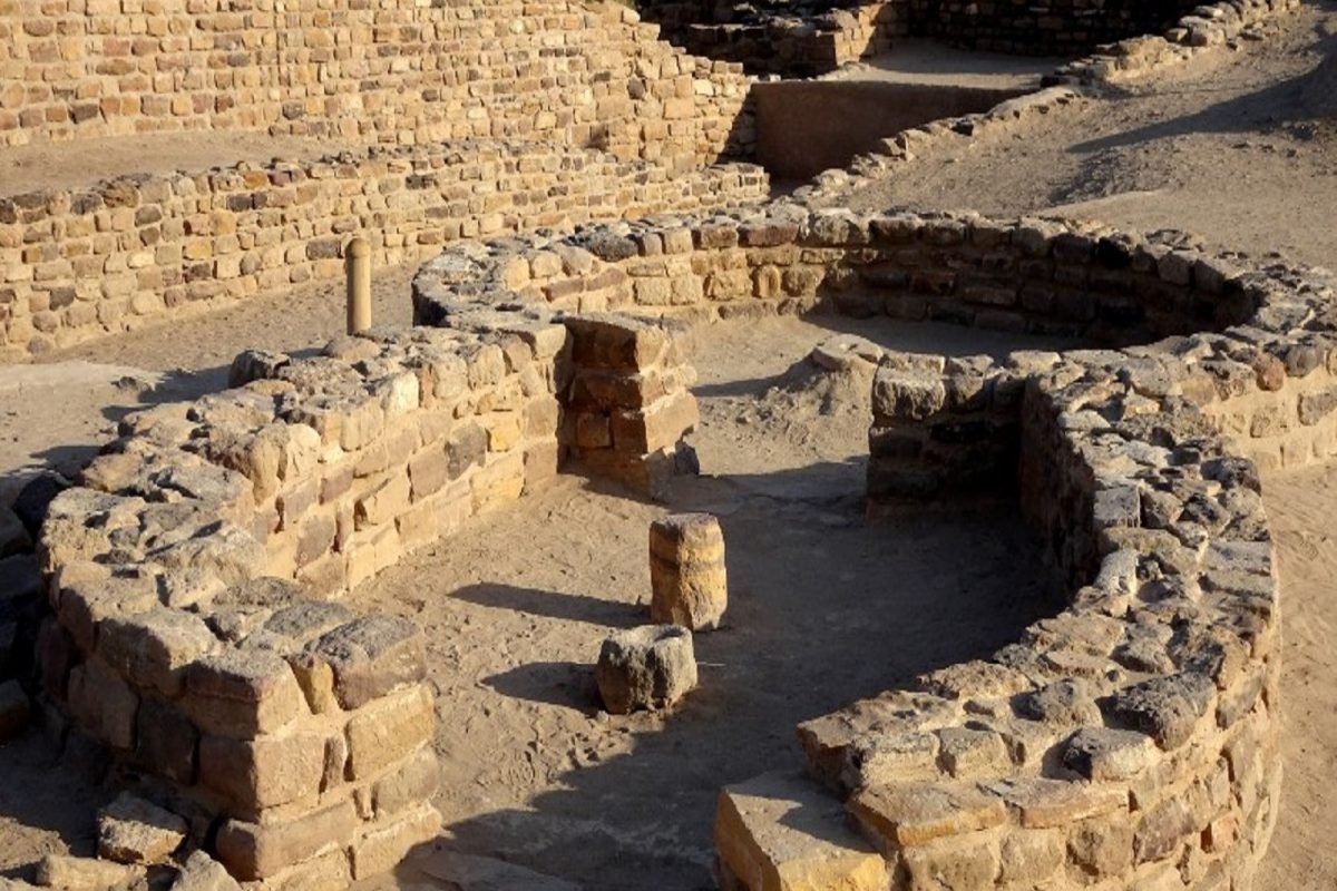
Massive walls constructed of stone and mud bricks encircled these areas, suggesting the necessity of fortifications—possibly as a means of defence against outside threats. There were unique buildings in each region, including residences and workshops in the lower town to administrative buildings in the citadel. Dholavira was also distinguished by its advanced water management system. Possibly due to the lack of water and pertaining to the area and location, the Harappans of Dholavira created a complex network of reservoirs, wells, and stormwater systems. Even in a hostile climate, Dholavira was able to remain a sustainable urban centre because of this network, which guaranteed a consistent supply of water for home consumption and agriculture.
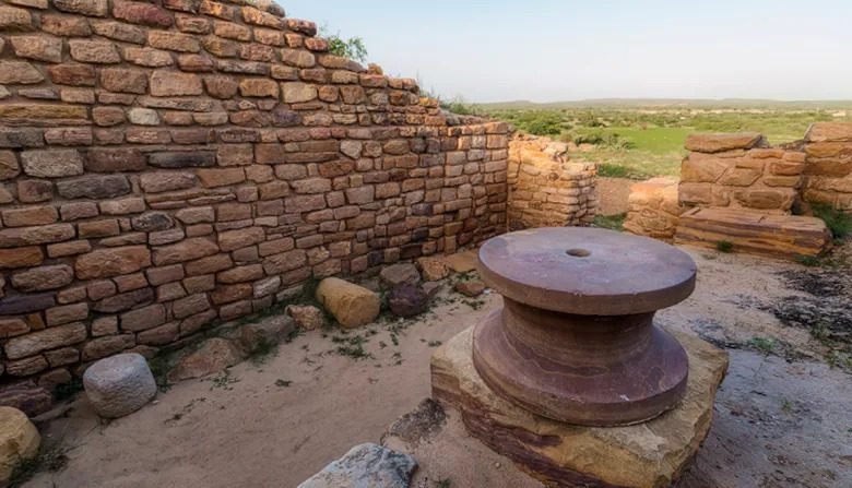
ASI began excavations in 1989 under the guidance of Bisht and conducted 13 excavations at the site between 1990 and 2005. This archaeological investigation resulted in the discovery of many cultural artifacts such as animal bones, gold and silver, pottery, ceramics, and brass, as well as revealing the structure and design of the city.
According to archaeologists, Dholavira was an important trading centre of Western Asia and the southern settlements of Gujarat, Sindh, and Punjab. During archaeological excavations of the site, bead processing workshops and objects of many kinds, including copper, shell, stone, jewellery made of semi-precious stones, terracotta, gold, ivory, and other materials, were discovered.

THE ARCHITECTURE
The three divisions
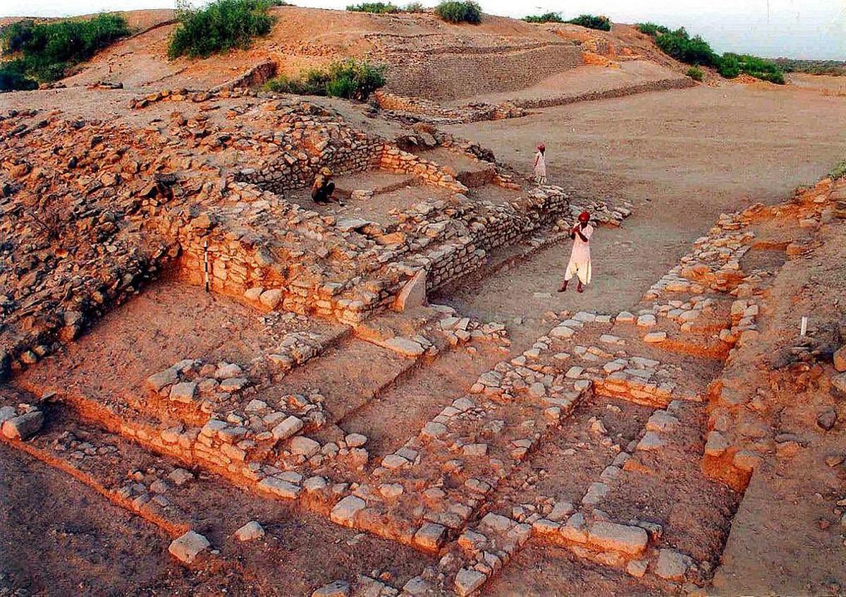
The citadel, middle town, and lower town were the three separate zones that made up the city. Unusual for Indus cities, this tripartite split illustrated how society and space were possibly organized hierarchically. Situated on the highest point, the citadel was probably the administrative and religious centre, well-guarded with enormous stone walls. Grand public buildings and structures, including sizable reservoirs and assembly halls that may have been used for celebrations and meetings, were located in this high zone.
The middle town was a residential neighbourhood for the city’s upper class, located next to the citadel and encircled by walls of its own. The mud bricks and stones used to build the larger, more ornate dwellings here demonstrated the wealth and social standing of the occupants. The working-class residents and artisans lived in the lower town, which was situated on the outskirts of the city. These were relatively modest homes, but they were nonetheless well-planned and had access to wells and drainage systems, among other necessities.
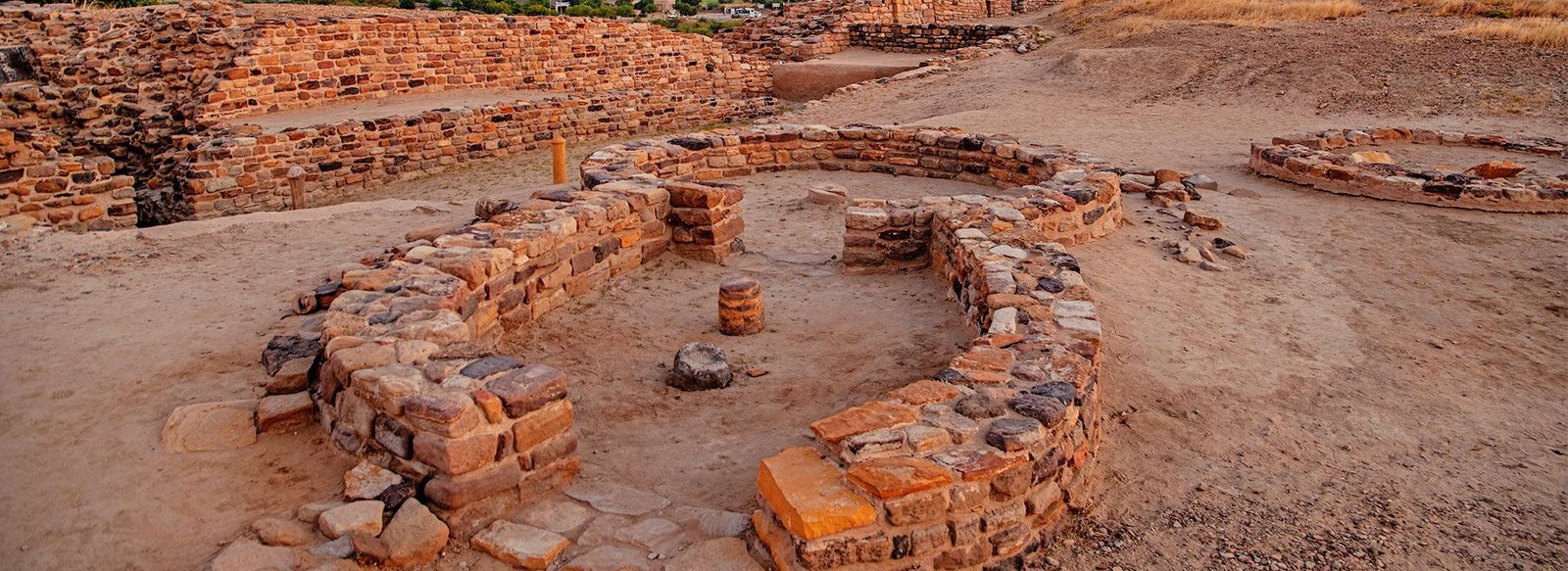
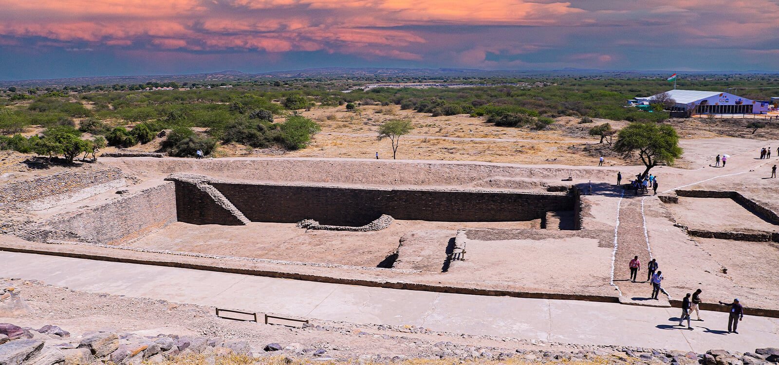
The reservoirs
Due to the severe water shortage that Dholavira experienced, the creation of an advanced water storage system was crucial to the city’s survival. A significant amount of storage capacity was guaranteed because some of the reservoirs were as deep as 12 meters. Using a complex network of channels and drains, the city planners cleverly redirected drainage and rainfall into these reservoirs to maximize water collection during the monsoon season. The city had massive reservoirs, three of which are exposed. Excavation of a rectangular step well that started in October of 2014 revealed that it was actually three times larger than the Great Bath of Mohenjo-Daro.
CURRENT SCENARIO AND PRESERVATION
Today, the Archaeological Survey of India (ASI) oversees a protected archaeological site where the ruins of Dholavira are conserved. The city’s walls, water reservoirs, and public buildings have all undergone repairs in order to preserve the structures. However, maintaining the site has proven to be a constant difficulty because to natural elements including wind, erosion, and the dry desert climate. Despite the ASI’s best efforts, degradation is unavoidable over time because a large portion of the site is composed of stone and mud-brick.
The ancient site of Dholavira is protected as an “ancient monument” of national significance by a Regulated Area that extends 200 meters in all directions from the boundaries of the Prohibited Area, and a Prohibited Area that is 100 meters in all directions from the protected monument’s boundaries. Since being designated a UNESCO World Heritage site in 2021, the Indian government has increased efforts to enhance accessibility and provide better facilities for visitors.
CONCLUSION
Dholavira is an excellent representation of the Indus Valley Civilization’s innovation and expertise. The Harappans were skilled engineers, as seen by their magnificent architecture, which features sophisticated water management systems and thoughtfully designed urban layouts. Even though the site is currently facing preservation issues, UNESCO and the Archaeological Survey of India are working hard to protect this priceless legacy.