INDIA AS WE SEE TODAY – The political and territorial transformation since independence
-Tanushree Wadodkar
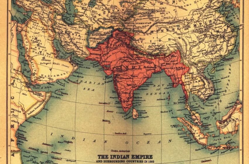
India has 28 states and 8 union territories. That is the map of India we know today. But it did not always look the same. Over the years, the boundaries within the country have undergone several changes. Territories have been acquired, states created on linguistic basis, and state boundaries altered.
As the population expanded and regional aspirations as well as conflict grew, new states were created to improve governance and representation, thus creating the map we see today.Let us look back and trace these changes from the time of independence.
1947: Partition and princely states
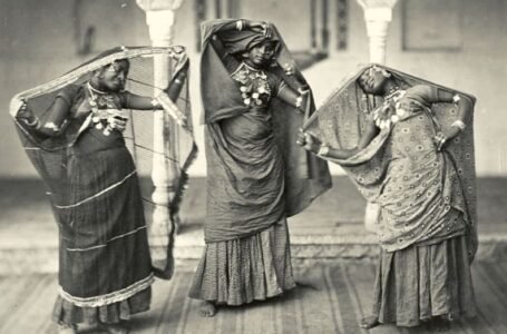
At the time of Independence, the country had been divided into India and Pakistan. It had been a long battle, and thousands of people had lost their lives on both sides of the border.
At the same time, there were about 565 officially recognised princely states in the country that had enjoyed independent autonomy under British rule. After the British left, these states had been given the choice to join India or Pakistan, or remain independent. Under the leadership of Sardar Vallabh Bhai Patel, most princely states signed the Instrument of Accession to join India.
The Nawab of Junagadh decided to join Pakistan, although the overwhelming Hindu population wanted to join India. Indian troops marched into the state, and voting was held in 1948, which favoured joining India.
In the case of Hyderabad, a police action was taken by the Government of India in 1948, leading to the surrender of Hyderabad on 17th September.
At the time of Independence, Kashmir was neither part of India nor Pakistan. In October 1947, when Pakistanis (backed by the army) attacked Kashmir, Maharaja Hari Singh requested help from India. After he signed the Instrument of Accession, the Indian Army was sent to help Kashmir.
Before they could completely drive out the Pakistanis, India agreed to a ceasefire. And thus, a part of Kashmir went under Pakistan’s control, which is now known as Pakistan-occupied Kashmir or PoK.
1950s: States Reorganisation
In 1950, states were divided according to the fourfold classification
- Part A States: Assam, Bihar, Bombay, Madhya Pradesh (formerly Central Provinces and Berar), Madras, Odisha (formerly Orissa), Punjab (formerly East Punjab), Uttar Pradesh (formerly the United Provinces), and West Bengal.
- Part B States: Hyderabad, Jammu and Kashmir, Madhya Bharat, Mysore, Patiala and East Punjab States Union (PEPSU), Rajasthan, Saurashtra, and Travancore-Cochin.
- Part C States: Ajmer, Bhopal, Bilaspur, Coorg, Delhi, Himachal Pradesh, Cutch, Manipur, Tripura, and Vindhya Pradesh.
- Part D States: Andaman and Nicobar Islands
The States Reorganisation Act, 1956, abolished this fourfold classification.
On the recommendation of the Fazal Ali Commission, 14 states (Andhra Pradesh, Madras, Kerala, Bombay, Bihar, Jammu & Kashmir, Assam, Gujarat, Uttar Pradesh, Mysore, Madhya Pradesh, West Bengal, Punjab, and Rajasthan) and 8 union territories (Delhi, Manipur, Andaman & Nicobar, Tripura, Himachal Pradesh, and Laccadive, Minicoy and Amindivi Islands) were created.
In 1953, Puducherry was merged into India after gaining independence from French rule and became a union territory.
Chandigarh and Lakshadweep became union territories in 1956.
1960s-2000: Later changes
The decades following the States Reorganisation Act saw further changes in India’s internal boundaries.
In 1960, the state of Bombay was divided into Maharashtra and Gujarat. Haryana was carved out of Punjab in 1966. Himachal Pradesh was elevated to statehood in 1970, and Meghalaya, Manipur, and Tripura in 1971. Mizoram and Arunachal Pradesh received the status of full statehood in 1986. Goa became a state in 1987 after being separated from Daman and Diu.
Sikkim was first given the status of an Associate State by the 35th Constitutional Amendment Act in 1974. It received full statehood in 1975 through the 36th amendment.
2000 onwards
Since 2000, four new states have been created.
Chhattisgarh, Uttarakhand, and Jharkhand were created in 2000, and Telangana was formed in 2014. This was done to simplify governance and uphold regional identities.
Recent Developments
In recent years, one of the most significant changes was the revocation of Article 370. Article 370 granted special autonomy to Jammu and Kashmir, allowing it to have its own constitution and other independent powers. In August, 2019, the Government revoked this special status, marking a significant shift in relations between the state and the central government.
Following this decision, the state of Jammu and Kashmir was reorganised into two union territories: Jammu and Kashmir and Ladakh. The aim was to bring the region under closer administrative control and facilitate development.
In conclusion, the map of India that we see today is not just a geographical outline of states. It is the result of decades of transformations and changes. From the integration of the princely states to recent developments like revoking Article 370, the internal boundaries of our country have evolved as a result of changing administrative needs and regional aspirations. Each change also tells a deeper story about identities and the effort to build a more unified and effective nation.
What’s also notable is that this was not a one-time process. Instead, India’s map has remained flexible and ready to accept change as per the needs of the people. The reorganisation of states based on language, the creation of new states to improve governance, and the restructuring of regions for better administration all show a system that responds to and adjusts with its citizens. This was not an easy process and often sparked debates and disagreements. But it still highlights the strength of democracy in our nation.
India’s map changes tell more than politics. It shows how the country keeps going and making progress. Countries and people both change over time. And India will also keep changing its map. But one thing will stay the same. The need for unity, safety, and growth for everyone as the world changes.